Credit: NOAA/NWS
Radar meteorology
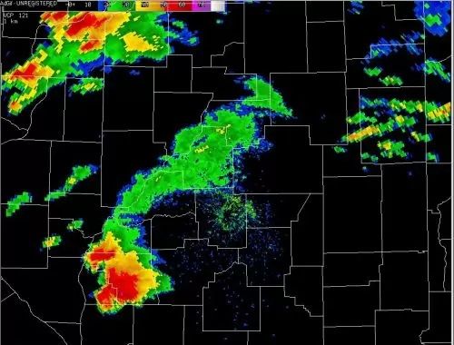
Doppler radar is a specific type of radar system that can detect all types of precipitation, the rotation of thunderstorm clouds, airborne tornado debris, and wind strength and direction.
Doppler radars work by transmitting short pulses of radio waves, then listening for returning signals that are reflected off a target, raindrops or snowflakes, back to the radar antenna. When the pulse hits a moving target, the phase of the returned signal is "shifted" or changed. This phase shift is known as Doppler shift. By measuring this shift, meteorologists and researchers can tell if targets are moving towards or away from the radar.
Rooted in wartime innovation
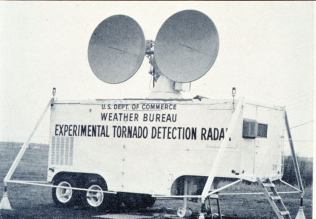
The technology behind Doppler radar is based on conventional radar systems that were originally designed to locate hostile aircraft during World War II. After realizing that these systems could also detect approaching storms, researchers began developing more advanced meteorological radar systems equipped for Doppler measurements.
Starting in 1960, NSF began funding software and hardware advances in ground-based and airborne Doppler radar technology, often in collaboration with other agencies like the National Oceanic and Atmospheric Administration.
Over the next several decades, as technology advanced and microprocessors became more affordable, Doppler radar became a critical forecasting tool of meteorologists and researchers. By the mid-1990s, the National Weather Service achieved comprehensive radar coverage of the continental U.S. and partial coverage of Alaska, Hawaii, Puerto Rico and Guam.

Credit: National Oceanic and Atmospheric Administration Photo Library

Credit: Justin Walker
Weather on wheels
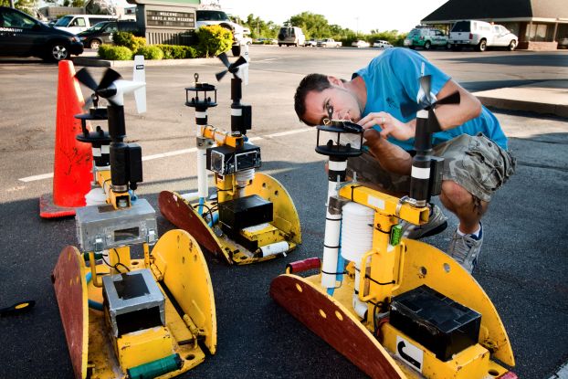
Since storms like tornadoes and hurricanes rarely move in the path of ideally spaced brick-and-mortar Doppler systems, Doppler on Wheels are mobile radars mounted on flatbed trucks that allow researchers to collect weather data at close range. They have been used to chase thunderstorms across tens of thousands of miles, collecting groundbreaking, detailed information on the inner workings of tornadoes, hurricanes and blizzards.
The first Doppler on Wheels (now one of three) was designed by NSF-funded researchers and deployed in 1995. Since then, these instruments have measured a world-record wind speed of 301 miles per hour just above ground level in an Oklahoma tornado and were the only "scientific team" to successfully brave Hurricane Ike's knockdown winds in Galveston, Texas.
Into the eye of a storm
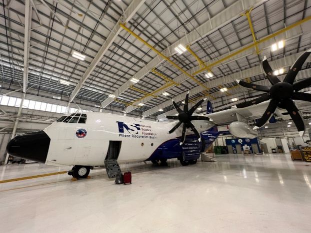
NSF continues to support advanced weather radar systems, funding the state-of-the-art Airborne Phased Array Radar, which can be attached to the outside of an aircraft and flown over land and oceans.
This new radar system will be able to get remarkably close 3D views of what is going on deep inside clouds and severe storms, providing a generational leap in understanding the formation of rain, hail and snow, as well as severe convective systems and tropical cyclones.

Credit: UCAR


